![]()
In our mission to ‘Connect the Curious’, NL Space Campus organises hackathons to boost space innovation and accelerate the space innovation ecosystem. These events are win-win: they spark new ideas for using space technology and data in practical ways, while also getting fresh talent excited about space. By mixing bright minds from different fields, we create a melting pot for quick problem-solving and out-of-the-box thinking. This approach isn’t just about cool tech – it’s about finding space-based solutions that can really make a difference for society and the economy. Plus, it’s a great way to show potential recruits how exciting and important the space industry is.

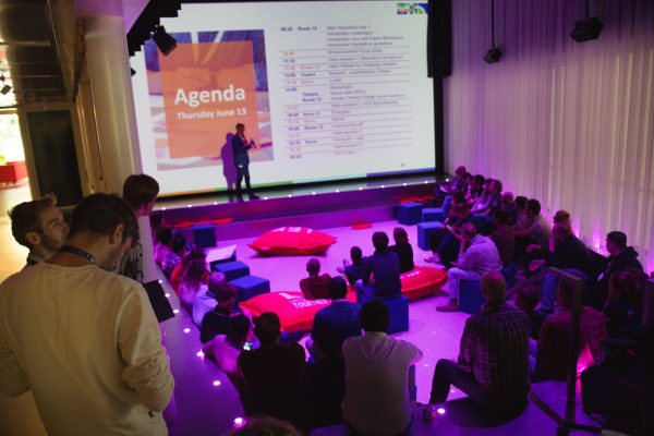
In an engaging blend of technology and public policy, the first-ever Geo-Data Fusion Hackathon was organised by the Ministry of Infrastructure and Water Management (I&W) and NL Space Campus, in partnership with Netherlands Space Office (NSO), Rijkswaterstaat, LEF Future Centre and Social Hackathon. It brought together entrepreneurs, students, startups and experts. The competition was focused on the use of satellite data to find solutions to important societal challenges that currently need to be addressed. The real-world challenges were provided by the Ministry of Infrastructure and Water Management and Rijkswaterstaat.
Geo-Data Fusion Hackathon: A New Way to Engage with Industry

The Geo-Data Fusion Hackathon aimed to unlock the potential of satellite data in offering solutions for three distinct challenges: finding the real ecological impacts of offshore wind farms, parking space optimisation and soil quality monitoring compliant with EU-regulation. The event provided a platform for cross-sector engagement and innovation.
Rike van Hattem, Senior Policy Officer at I&W, emphasised the importance of these collaborations: “This hackathon allowed us to invite a broad range of experts and address challenges using satellite data, which wouldn’t be possible through standard procurement processes. Hackathons inspire creativity and collaboration, providing fresh perspectives on common issues.”
Rike states: “I’m not an expert, but I’ve seen firsthand how this hackathon has sparked new ideas, like using previously unknown data sources for our parking challenge. It’s a unique opportunity to explore numerous data sources and find innovative solutions cost-effectively. Collaboration in a hackathon multiplies our problem-solving capabilities beyond our initial expectations.”
Jasper van Loon, board member of NSO added: “One of NSO’s goals is to promote the use of satellite data, and the Hackathon can be one of the ways of promotion. With a large number of participants (48 to be exact), the event not only seeks winning ideas but also values those who didn’t make it, looking for useful concepts that can be further developed. While participants might not always have the answers, they generate significant awareness. In this collaborative environment, a pot of ideas quickly transforms into innovative solutions, encouraging everyone to think outside the box about new applications.”
“For a long time, the space sector was seen mainly as a source of scientific knowledge and technological development. This view needs adjustment: in the Netherlands, significant advances have been made, including satellite instruments production. The establishment of the European Space Agency Test Facilities (ESA ESTEC) in Noordwijk, government investments, space-related activities at Dutch universities, and the NL Space Campus in Noordwijk, stimulated by the Netherlands Space Office (NSO), have all boosted Dutch economy and science.”
“However, the societal applications of Earth observation remain underutilised, despite numerous opportunities to use space-related products and applications for planning, implementing, and monitoring for, amongst others, Dutch policies. To use satellite data for policy purposes, the added value of this data in relation to policy themes, deserves more recognition”.
Hackathon Challenges
The hackathon presented three core challenges:
Challenge 1: Wind Turbines in the North Sea – Impact on Ecology
Challenge 1 focused on reducing the negative environmental impacts and exploring potential beneficial effects of offshore wind farms on the North Sea’s ecology. The goal was to use remote sensing technologies to analyse the influence of these wind farms.
Rinus Schroevers, Senior Advisor on Strategic Projects at Rijkswaterstaat, shared insights of the challenge: “At Rijkswaterstaat, we supply data on various areas in the Netherlands, including the North Sea. With the construction of wind farms, it’s crucial to have data before, during, and after construction to assess the impact. Remote sensing is a potential new data source, but we need to determine its effectiveness and quantify the effects of wind farms, which is the main challenge. This hackathon aims to get a quantifiable measure of these impacts. We have three teams working on the challenge, each with a different focus. One team focuses on data, another on how to communicate results to users, and the third on technical details. This diversity of viewpoints is valuable, even if a complete working solution is not achieved. The different approaches help us avoid focusing too much on one aspect. It’s important to consider what our end users, such as politicians, need for decision-making. Observing where teams get stuck helps us understand if the issue lies in the data provided or in the teams’ knowledge. If the hackathon proves productive, there might be projects that can use these solutions.”
Challenge 2: Optimising Urban Spaces with Satellite Data
Addressing the issue of valuable urban spaces being occupied by occasionally used vehicles, The second challenge sought to utilise satellite data to perform accurate parking counts and enhance awareness of stationary vehicles, aiming to optimise city space utilisation. With this information, city planners can create more space for shared mobility or for example, more trees.
Edoardo Felici, Policy Coordinator at the Directorate for Innovation in Mobility, I&W, explained, “What we do is that we work a lot on mobility innovations and try to understand how we can use data to make our work a lot more impactful and efficient. And that’s also what our challenge is dealing with today. We have a parking challenge or actually mostly a spatial challenge to try to use satellite data to understand the impact of cars and mobility on public space and opportunities to free up this space for other purposes. This is a novel approach for us, and we’re excited to see the innovative solutions.”
Challenge 3: Soil Monitoring at High Altitudes
The final challenge aimed to connect advanced earth observation technologies with EU-compliant soil measurements to create actionable insights for soil quality assessment and improvement.
Silko Mergenthal, Policy Maker at I&W, highlighted the challenge’s significance: “With the upcoming European Soil Directive, setting up a soil monitoring system will be a big task. This hackathon is a step towards finding innovative solutions for soil quality assessment.”
Best Solutions of the Hackathon
The hackathon concluded with several noteworthy solutions, each demonstrating innovative approaches to the presented challenges.
1st Place Award: SoilSpectrum – Soil Quality Dashboard

SoilSpectrum emerged victorious by addressing the pressing need for soil quality monitoring across the Netherlands. Their solution features an accessible dashboard that assesses compliance with new EU guidelines on soil health. By integrating various data sources, SoilSpectrum aims to scale up its pilot project from a small area to cover a broader region. This initiative promotes environmental sustainability and facilitates informed decision-making for policymakers and land managers. Recognised for its practical application and alignment with EU directives, SoilSpectrum’s proposal promises significant advancements in soil management practices nationwide.
Team members are sharing their experiences: “Learning about satellite data was eye-opening. We didn’t realise its potential in fields like soil science, which is why we chose this challenge. It’s fascinating to see how versatile and useful this data can be.”
SoilSpectrum has been invited to propose a project to NSO, with a maximum of € 20.000 available to advance the idea further within the next two years. During these two years we will share updates about the team’s developments.
Runner-Up: ParkSense – Vehicle Index for Urban Planning

ParkSense impressed the jury with their innovative approach to urban planning using satellite data. Their solution involves creating a vehicle index based on historical satellite data to identify underutilised parking spaces in public areas. By repurposing these spaces for housing or public green areas, ParkSense aims to optimise urban infrastructure and improve traffic flow dynamics. They have already developed a functional prototype and plan to enhance their technology by overcoming challenges like cloud interference in satellite imaging. Winning both the runner-up title and the public choice award demonstrates their impactful vision for urban development.
Team members are sharing their experiences: “So, it felt like we were inventing something that really made an impact, and we enjoyed that a lot. It was not our first hackathon, but it was a very cool experience and the first with an actual client.”
ParkSense is invited to develop its idea into a proposal for NSO with a maximum of € 10.000 available within the upcoming two years. We will also share any developments this team makes in the upcoming years.
Findings and Future Directions

The hackathon’s success underscored the value of collaboration with ministries and the market and innovative thinking in addressing societal challenges through satellite data.
Rike van Hattem (I&W) reflected on the event’s impact: “Hackathons inspire creativity and collaboration, providing fresh perspectives on common issues. This hackathon sparked new ideas and showed the potential of previously unknown data sources. With all the ideas devised during this hackathon, I can show my colleagues how satellite data can address our ministry’s challenges in practice.”
Jappe Jongejan (NSO) reflects on the impact of a hackathon for governments seeking to innovate: “Participating in events like hackathons allows us to showcase innovative solutions leveraging satellite data. It’s important to promote space technology for governmental needs and show the potential it offers to fully utilise the investments made by our society.”
Jasper van Loon (NSO) elaborated on how the Netherlands Space Office can be a vital resource for entrepreneurs with innovative ideas. Beyond participating in hackathons, NSO offers several avenues for support and collaboration:
- Funding for Innovation Projects: NSO has a budget available for government-led innovation projects.
- Letters of Authorisation: NSO can provide Letters of Authorization to Dutch companies looking to apply for ESA programmes like InCubed, BASS, or GSTP, which are often entrepreneur-led.
- Government-Led Challenges: NSO initiates government-led challenges that entrepreneurs can apply to, fostering a collaborative environment for advancing space-related innovations.
- Entrepreneur Support: Entrepreneurs with innovative ideas can contact NSO to discuss potential support.
By offering these resources and creating platforms for collaboration, NSO helps to transform innovative ideas into viable solutions that address both current and future challenges.
Marc Sandelowsky of NL Space Campus was part of the jury that evaluated the solutions offered by the teams. “As jury members, we were genuinely impressed by the calibre of solutions presented today. The teams have demonstrated not only technical prowess but also a deep understanding of the challenge owners’ needs. This hackathon has proven its worth to the space ecosystem, bringing fresh perspectives and innovative approaches to real-world issues for which space data was not previously considered. Selecting a winner was no easy task – the quality across the board was outstanding. It’s clear that events like these are crucial in driving our space sector forward and showcasing the talent we have in The Netherlands. Regardless of the final rankings, every team should be proud of their contributions. You’ve all played a part in advancing our mission to accelerate space innovation for a better world.”

Space data is becoming more important for environmental management, urban planning, and disaster response, offering historical and current data for predictive analytics. Technological advances improve data accuracy and availability, with smaller satellites complementing larger missions. Initiatives like the Netherlands Space Office’s Satellite Data Portal maximise satellite data’s public benefit, informing policy and driving innovation in environmental and water management sectors. These efforts capitalise on satellite data’s potential to enhance monitoring, develop advanced services, and improve societal outcomes.
The Geo-Data Fusion Hackathon has fostered innovative solutions and also strengthened the collaboration between government bodies, IT specialists, and data experts, paving the way for a future where satellite data plays a pivotal role in solving societal challenges. This hackathon has fostered many collaborations, opened up possibilities in practice for many departments at ministries and is only the first step in strengthening the potential of satellite applications in the Dutch space ecosystem.
As NL Space Campus we will keep facilitating collaborations and creating opportunities for solutions, business and networking, and share them with the community. If you want to stay informed, visit our website regularly, as we will follow the stories of awarded teams and post more details about the challenges presented at the Hackathon. Additionally, you can subscribe to our newsletter to receive almost monthly updates from our community directly in your inbox.